ContenuPrincipal

Hiking trips

How about letting TER take you closer to your nature cravings ?

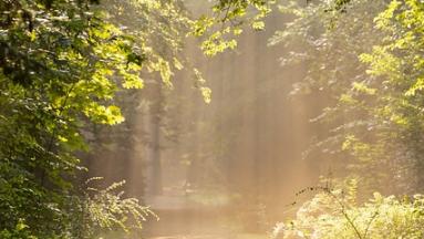
Nature has never been so precious

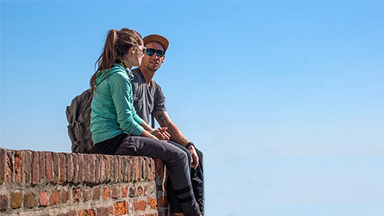
To reconnect, to breathe, to draw inspiration by giving time to time.
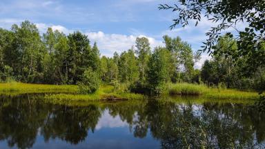
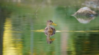
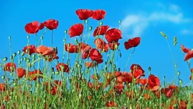
Just a train ride away, there are a thousand and one ways to get some fresh air. Day hikes, family outings to observe the small and big wonders of the wild world, bike trips to explore new horizons...

Close to Paris, between woods and marshes.

The Mont Saint-Siméon

  • Departing from Noyon station (D4 on the map)
  • Marked hiking trail from the Tourist Office
  • 2h55 on foot
  • 11.6 km
  • 237 m elevation gain
  • Difficult level
  • Yellow trail markers

The Tour of the Marais d'Isle

  • Departing from Saint-Quentin station (D3 on the map)
  • 2 hours on foot
  • 6 km
  • Easy level
  • Yellow and blue trail markers

Around Artois for a breath of countryside air

Around Artois for a taste of the countryside

  • Departing from Béthune station (C2 on the map)
  • Marked hiking trail from the Belfry (Grand'Place)
  • 2h15 on foot
  • 10 km
  • Easy level
  • Hike: La Catorive
  • Yellow trail markers

The Pas de Saint-Martin, discoveries at every step

  • Departing from Pernes-Camblain station (B3 on the map)
  • Marked hiking trail from the parking lot on Rue de la Paix
  • 3h15 on foot
  • 15 km
  • 151 m elevation gain
  • Moderate level
  • Yellow trail markers

In the heart of Avesnois, nature and history

Circuit of the Ramparts

  • Departing from Le Quesnoy station (D3 on the map)
  • Marked hiking trail from Place Général Leclercq
  • 1h40 on foot
  • 5 km
  • Easy level
  • Yellow trail markers

Circuit of the Vertain Mill

  • Departing from Templeuve station (D2 on the map)
  • 3 or 4 hours on foot
  • 11.5 km or 14 km
  • Moderate level
  • Yellow trail markers

Circuit of the Forges

  • Departing from Anor station (E3 on the map)
  • Marked hiking trail from the hamlet of La Vieille Verrerie
  • 3 hours on foot
  • 9 km
  • Easy level
  • Red and yellow trail markers

Organize your hike along the coastline

  • Between Dunkirk and Berck-sur-Mer
  • Main stations to start the route and plan your return: Dunkirk, Calais, Wimille-Wimereux, Boulogne-sur-Mer, Étaples-Le Touquet, Berck
  • (B1, A1, and A2 on the map)
  • Hike
  • GR 120
  • White and red trail markers

Discover even more sports activities